


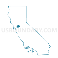
Voting District 51230, Solano County, California
About
Outline

Summary
| Unique Area Identifier | 544442 |
| Name | Voting District 51230 |
| County | Solano County |
| State | California |
| Area (square miles) | 2.77 |
| Land Area (square miles) | 2.76 |
| Water Area (square miles) | 0.01 |
| % of Land Area | 99.74 |
| % of Water Area | 0.26 |
| Latitude of the Internal Point | 38.32199940 |
| Longtitude of the Internal Point | -121.88045320 |
Maps


Graphs
Select a template below for downloading or customizing gragh for Voting District 51230, Solano County, California


Neighbors
Neighoring Voting District (by Name) Neighboring Voting District on the Map
- Voting District 51220, Solano County, CA
- Voting District 51235, Solano County, CA
- Voting District 51245, Solano County, CA
- Voting District 51260, Solano County, CA
- Voting District 51275, Solano County, CA
Top 10 Neighboring County Subdivision (by Population) Neighboring County Subdivision on the Map
- Vacaville CCD, Solano County, CA (100,015)
- Dixon CCD, Solano County, CA (21,253)
- Rio Vista CCD, Solano County, CA (8,423)
Top 10 Neighboring Unified School District (by Population) Neighboring Unified School District on the Map
- Vacaville Unified School District, CA (77,469)
- Travis Unified School District, CA (29,935)
- Dixon Unified School District, CA (21,340)
Top 10 Neighboring State Legislative District Lower Chamber (by Population) Neighboring State Legislative District Lower Chamber on the Map
Top 10 Neighboring State Legislative District Upper Chamber (by Population) Neighboring State Legislative District Upper Chamber on the Map
Top 10 Neighboring 111th Congressional District (by Population) Neighboring 111th Congressional District on the Map
Top 10 Neighboring Census Tract (by Population) Neighboring Census Tract on the Map
- Census Tract 2535, Solano County, CA (8,423)
- Census Tract 2529.15, Solano County, CA (3,506)
- Census Tract 2533, Solano County, CA (2,743)